(nearing completion)
Looking to the South-West from Bona Lighthouse ©
2001 Dick Raynor.
Bona Narrows and Lighthouse.
Looking to the South-West from Bona Lighthouse ©
2001 Dick Raynor.
Bona Narrows and Lighthouse.
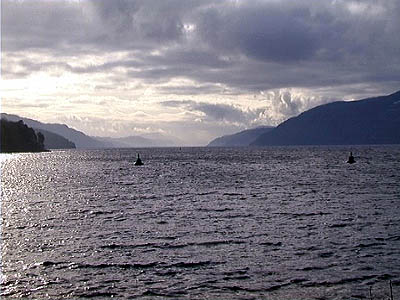
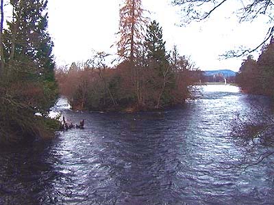
The north-eastern end of Loch Ness is usually taken as being Bona Narrows, where the water flows out of the loch on its journey to the sea. The view above shows Bona lighthouse, with Loch Ness beyond, taken from the south-eastern shore. The Narrows are 85 metres wide. From this viewpoint, turning to the right, you can see downstream to the wider parts of Loch Dochfour, shown below.
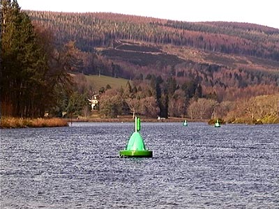
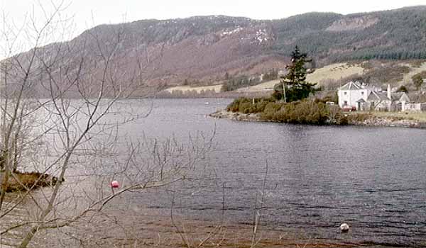
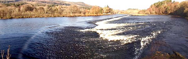
View to Loch Dochfour © 2001 Dick Raynor.So far, the water is still at the level of Loch Ness, and passes through a channel which is very shallow in places, requiring a series of navigational buoys to mark the deep water, but this changes 2 km away at Dochfour Weir, shown below from the south-eastern shore.
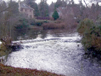
This weir was constructed during the building of the Caledonian Canal by Thomas Telford in the first two decades of the 19th century. It caused the level of Loch Ness to be raised by about 8 feet compared to its earlier level, and it is now about 16 metres above Ordnance Datum. In the picture above, the water at Loch Ness level is on the left of the picture, and vessels heading from Loch Ness towards Dochgarroch Lock stay well clear of the weir. The stone cill is visible in the picture, curving round from the left, about 30cm beneath the surface. The River Ness, on the right hand side of the picture, starts its 12km journey to the sea here. Any creatures passing between the sea and Loch Ness must pass this point. Loch Dochfour is 150 metres wide at this point. The total length of the weir is over 500 metres, but most of the water flows over it in the south-western half of this distance.
Dochfour Weir© 2001 Dick Raynor.
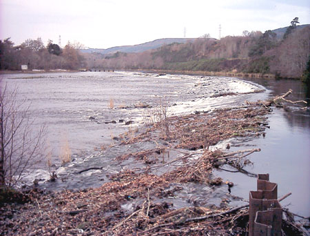
Weir at Holm Mills
Copyright © 2002 Dick Raynor.The present structure is an amalgam of a weir originally constructed to provide a head of water to power the woollen mill - the five dark objects at the far end of the weir are sluice gates where the water flow to the mill was controlled - while the foreground structure dates from the 1920's and supplied water to the hydro-electric generating station at Bught. The Ness Islands are about 1 km downstream of this point, a favourite spot for anglers. During the construction of the Caledonian Canal massive civil engineering works were carried out resulting in lasting changes to the course and character of the river.
Migratory fish and seals can easily negotiate this obstacle.
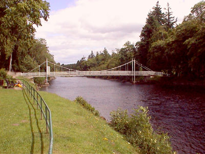
Bridge to Ness Islands © 2001 Dick Raynor.
The Ness Islands© 2001 Dick Raynor.
On the Ness Islands© 2001 Dick Raynor.
On the Ness Islands© 2001 Dick Raynor.
On the Ness Islands© 2001 Dick Raynor.
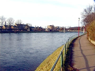
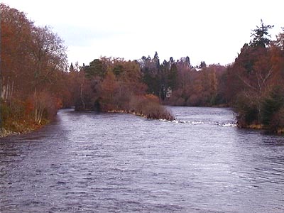
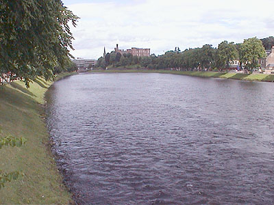
Looking downstream near the Ness Islands to the Infirmary Footbridge.© 2001 Dick Raynor.In this view, Inverness Castle is on the right, and St. Andrews Cathedral is on the left. Anglers frequently walk across the river wearing waders in this area. The river is about 100 metres wide, and between 30 and 100 cm deep. After heavy storms the river can rise to the level of the footbridge walkway.
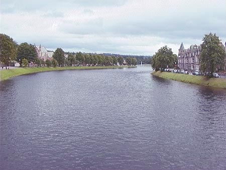
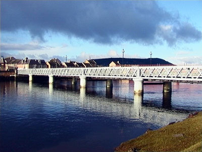
Infirmary Footbridge.© 2001 Dick Raynor. The River Ness flows through the town centre of Inverness, and there are roads or footpaths along both banks for several kilometres between the river mouth and the Ness Islands area.This is the oldest of the three road bridges over the River Ness, and also the most northerly. In this picture we look downstream to the north, from the east bank, and can see the reflection of the red-painted railway bridge in the water. Beyond the railway bridge is the stretch of riverside known as Inverness Harbour.
Inverness Castle from the Infirmary Footbridge © 2001 Dick Raynor.
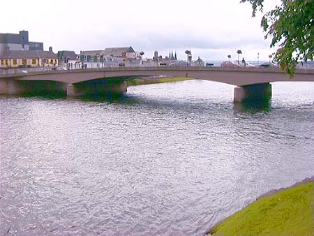
View from Ness Bridge looking South towards Loch Ness © 2001 Dick Raynor.
Ness Bridge from below Castle © 2001 Dick Raynor.
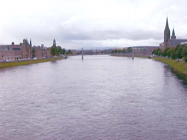
Looking North towards the sea from Ness Bridge © 2001 Dick Raynor.
The Black Bridge.© 2001 Dick Raynor.
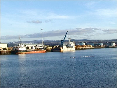
Inverness Harbour© 2001 Dick Raynor.
This is the widest stretch of the River Ness
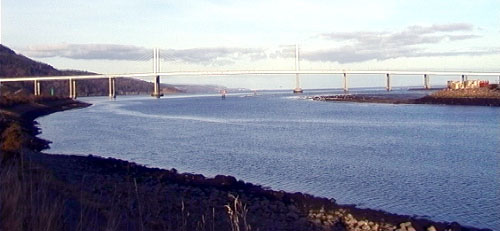
Mouth of the River Ness, with Kessock Bridge beyond. © 2001 Dick Raynor.
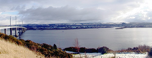
Kessock Bridge and Ness river mouth from Craigton. © 2001 Dick Raynor