
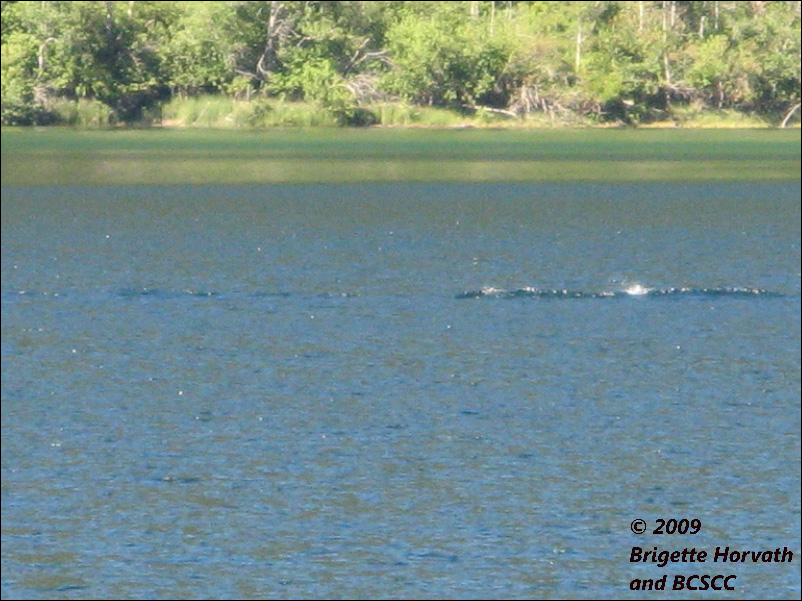
Cameron Lake photo discussed
A suggested location and explanation for surface effects recorded on Cameron Lake, Vancouver Island, British Columbia, Canada
on 30th July 2007 by Ms Brigette Horvath.
Dick Raynor, 25th February 2014.
INTRODUCTION
On 30th July 2007 Ms Horvath was driving on Highway 4 when she noticed a disturbance on the surface of Cameron Lake. One photograph has been published of the disturbance and has been claimed as evidence of a large unknown animal. Boat wake effects were discarded by local investigators on the grounds that no boats were visible to the photographer. It is also asserted that the photograph was taken near the "swimming area" at the eastern end of the lake.
PURPOSE
My examination suggests a different location for the photography and shows how a boat could easily have been responsible for the disturbance and still not be visible to the photographer.
COMMENT
The photograph shows a patch of water with an object or disturbance on the surface and in the background there is a stretch of bushy shoreline and reed-beds. The assumed location at the eastern end of the lake has a rocky or stony shore and no reed-beds due to the frequently choppy conditions experienced there.
Above - GoogleEarth aerial photo of the east end of Cameron Lake showing stony shore and no reed beds
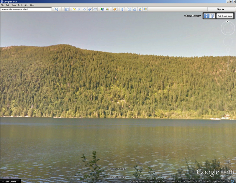
Above - GoogleEarth StreetView photo of the east end of Cameron Lake - wide view
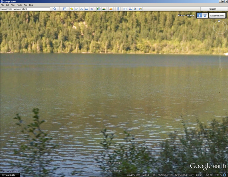
Above - GoogleEarth StreetView photo of the east end of Cameron Lake - zoomed in view of the shoreline stated to be the background to the cryptid photograph.
If the photographer was on Highway 4 as stated, the background would show the north shore of the lake, about 700 metres away. At this distance individual tree trunks are barely discernable.
In the picture under discussion, the vegetation has clearly visible branches and leaves and even individual reed stems are resolved. The distance to the background shore must be significantly less than 700 metres, and the environment must be of a much lower energy. The obvious location which permits such a photograph from H4 is at the western end of the lake. Careful study of StreetView imagery reveals a suitable location where the lake can be viewed through the trees and the opposite shore is about 170 metres away.
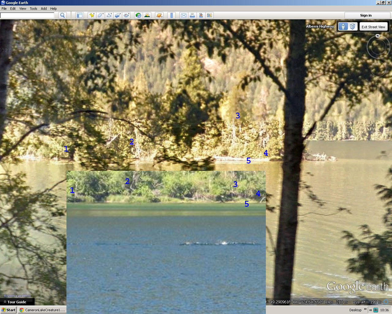
The GoogleEarth images appear to be recorded at intervals of 10-20 metres and so an exact parallax match is not to be expected, but in the image above I have identified 5 features present in both the original photograph and in the GoogleEarth imagery recorded about 6 years later. #1 appears to be a sloping clump with an embayment to the right, #2 is a distinctive pale curved branch, #3 is a clump of trees somewhat back from the water's edge having similar arrangement and spacing, just to the left of the numeral #4 is a small cruciform tree trunk looking rather like an airliner pointing upwards and #5 is the reed bed in both photographs. Furthermore, the scale of the vegetation is the same. I am satisfied that the background shown is the same in both photographs.
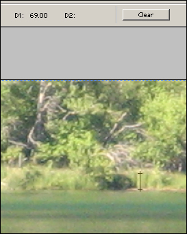
As an extra check, above is a small part of the photograph showing the distinctive curved tree-branch and some reeds in the foreground. In Adobe Photoshop the height of the reeds is measured at 69 pixels. The camera has the same angle of view as a 210mm lens on 35mm film, according to the data. It can be shown that at a distance of 180 m across this little bay the horizontal field of view is 2x (18/210 x 180) metres, which is 30.86m. The resolution is 3072 x 2304 pixels so at this distance the scale is almost exactly 100 pixels per metre. The reeds are therefore 69cm high, which I think is reasonable. If they were across the water at the east end of the lake where it is at least 700 metres wide the reeds would need to be 3.9 times higher, or 2.7 metres - 9 feet in height. All photographs I have found show a reed-free stony northern shoreline at the eastern end of the lake.
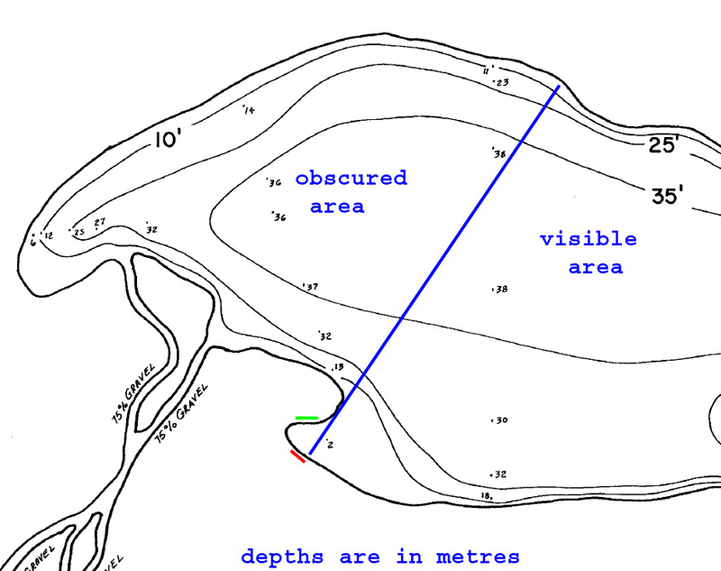
The chart extract above shows the location of the photographer - somewhere along the red line, the location of the background shoreline in green and a blue line dividing distant shore visible and obscured from the photographers location.
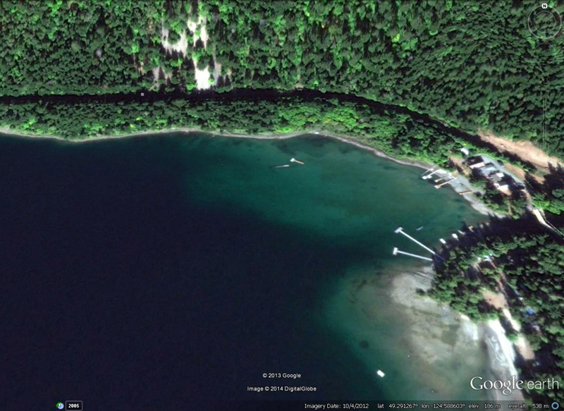
In the photo below, the paler shallow area at the entrance to the bay would also have the effect of causing residual boat wakes which might not be visible in deep water to build up, change direction and sometimes break as they progressed into water less than 0.5 wavelengths in depth. This shoaling, refraction and breaking of the waves would create interesting and perhaps misleading impressions in people not familiar with the processes involved.
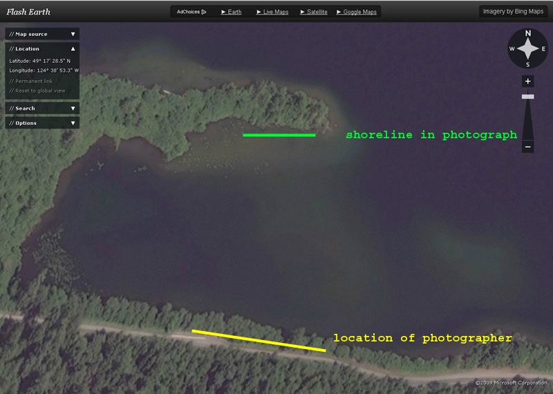
The GoogleEarth image above shows the bay in question together with the distant shoreline which appears to be dotted with boat docks. A boat could have made the disturbance in the photograph under discussion and then proceeded to one of the docks and be out of sight before the photographer appeared on the scene.
CONCLUSION
The assertion that the Horvath photograph was taken at the east end of Cameron Lake is mistaken. The background in the photograph has a good match in a small bay at the west end of the lake, from where a boat responsible for the waves in the photograph would not necessarily be visible.